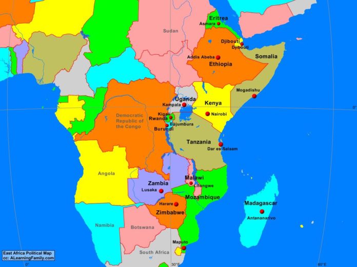
The East Africa political map is provided. The political map includes a list of neighboring countries and capital cities of East Africa.
A student may use the blank East Africa outline map to practice locating these political features.
Features of the East Africa Political Map
Neighboring Countries
- Angola
- Botswana
- Democratic Republic of the Congo
- Namibia
- South Africa
- Sudan
Countries and Capitals
- Burundi (Bujumbura)
- Djibouti (Djibouti)
- Eritrea (Asmara)
- Ethiopia (Addis Ababa)
- Kenya (Nairobi)
- Madagascar (Antananarivo)
- Malawi (Lilongwe)
- Mozambique (Maputo)
- Rwanda (Kigali)
- Somalia (Mogadishu)
- Tanzania (Dar es Salaam)
- Uganda (Kampala)
- Zambia (Lusaka)
- Zimbabwe (Harare)
Bodies of Water
- Gulf of Aden
- Indian Ocean
- Lake Victoria
- Mozambique Channel
- Red Sea
Major Landforms
- Ethiopian Highlands
- Great Rift Valley
- Jubba River
- Madagascar Ridge
- Mitumba Mountains
- Mozambique Ridge
- Muchinga Mountains
- Serengeti Plain
- Somali Peninsula
- Zambezi River

