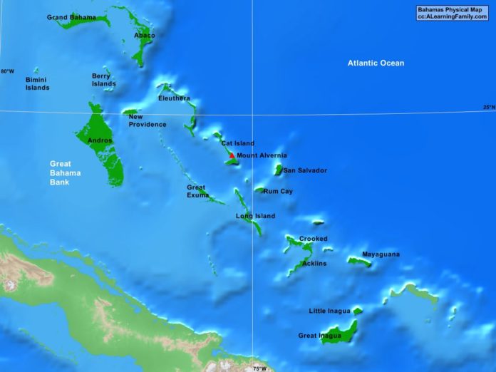
The Bahamas physical map is provided. The physical map includes a list of major landforms and bodies of water of the Bahamas.
A student may use the blank Bahamas outline map to practice locating these physical features.
Features of the Bahamas Physical Map
Bodies of Water
- Atlantic Ocean
- Great Bahama Bank
Major Landforms
- Abaco
- Acklins
- Andros
- Berry Islands
- Bimini Islands
- Cat Island
- Crooked
- Eleutheria
- Grand Bahama
- Great Exuma
- Great Inagua
- Little Inagua
- Long Island
- Mayaguana
- Mount Alvernia
- New Providence
- Rum Cay
- San Salvador

