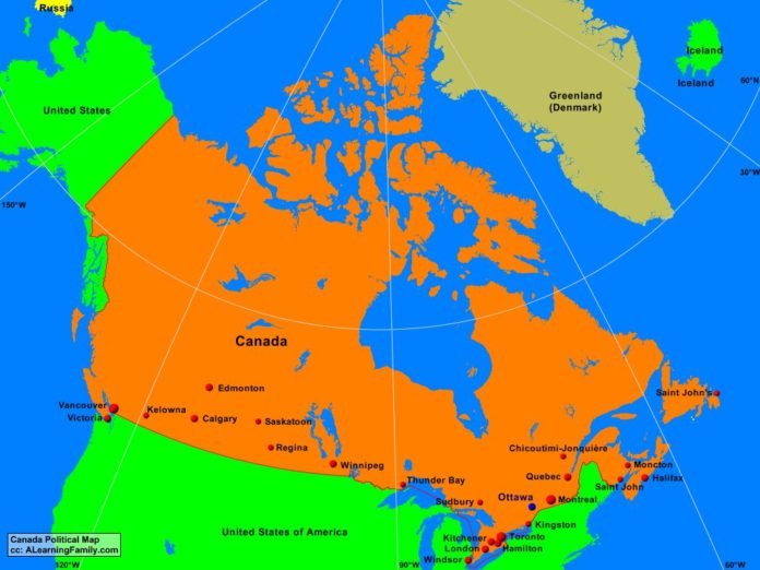
The Canada political map is provided. The political map includes a list of neighboring countries and major cities of Canada.
A student may use the blank Canada outline map to practice locating these political and physical features.
Features of the Canada Political Map
Neighboring Countries
- Greenland (Denmark)
- Iceland
- Russia
- United States
Major Cities
- Ottawa (capital)
- Calgary
- Chicoutimi-Jonquiere
- Edmonton
- Halifax
- Hamilton
- Kelowna
- Kingston
- Kitchener
- London
- Moncton
- Montreal
- Quebec
- Regina
- Saint John
- Saint John’s
- Saskatoon
- Sudbury
- Thunder Bay
- Toronto
- Vancouver
- Victoria
- Windsor
- Winnipeg

