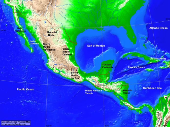
The Central America physical map is provided. The physical map includes a list of major landforms and bodies of water of Central America.
A student may use the blank Central America outline map to practice locating these physical features.
Features of the Central America Physical Map
Bodies of Water
- Atlantic Ocean
- Caribbean Sea
- Gulf of California
- Gulf of Mexico
- Pacific Ocean
Major Landforms
- Baja California
- Cayman Trench
- Greater Antilles
- Mesa del Norte
- Middle America Trench
- Mosquito Coast
- Sierra Madre del Sur
- Sierra Madre Occidental
- Sierra Madre Oriental
- Yucatan Peninsula

