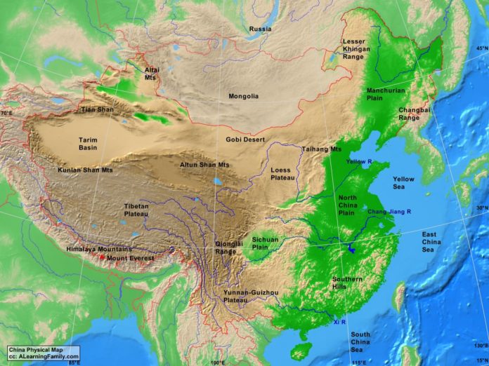
The China physical map is provided. The physical map includes a list of major landforms and bodies of water of China.
A student may use the blank China outline map to practice locating these physical features.
Features of the China Physical Map
Bodies of Water
- East China Sea
- South China Sea
- Yellow Sea
Major Landforms
- Altai Mountains
- Altun Shan Mountains
- Chang Jiang River
- Changbai Range
- Gobi Desert
- Himalaya Mountains
- Kunlan Shan Mountains
- Lesser Khingan Range
- Loess Plateau
- Manchurian Plain
- Mount Everest
- North China Plain
- Qionglai Range
- Sichuan Plain
- Southern Hills
- Taihang Mountains
- Tarim Basin
- Tian Shan
- Tibetan Plateau
- Yellow River
- Yunnan-Guizhou Plateau

