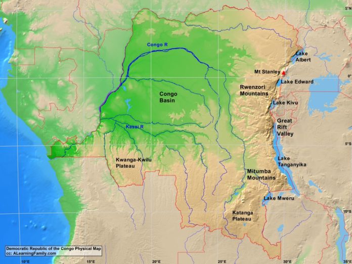
The Democratic Republic of the Congo physical map is provided. The physical map includes a list of major landforms and bodies of water of the Democratic Republic of the Congo.
A student may use the blank Democratic Republic of the Congo outline map to practice locating these physical features.
Features of the Democratic Republic of the Congo Physical Map
Bodies of Water
- Atlantic Ocean
- Lake Albert
- Lake Edward
- Lake Kivu
- Lake Mweru
- Lake Tanganyika
Major Landforms
- Congo Basin
- Congo River
- Great Rift Valley
- Kassi River
- Katanga Plateau
- Kwanga-Kwilu Plateau
- Mitumba Mountains
- Mount Stanley
- Rwenzori Mountains

