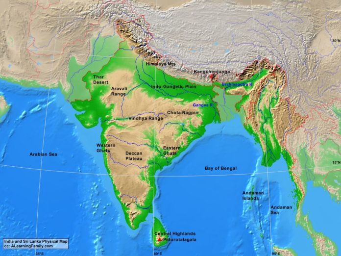
The India and Sri Lanka physical map is provided. The physical map includes a list of major landforms and bodies of water of India and Sri Lanka.
A student may use the blank India and Sri Lanka outline map to practice locating these physical features.
Features of the India and Sri Lanka Physical Map
Bodies of Water
- Andaman Sea
- Arabian Sea
- Bay of Bengal
Major Landforms
- Andaman Islands
- Aravali Range
- Brahmaputra River
- Central Highlands
- Chota Nagpur
- Deccan Plateau
- Eastern Ghats
- Ganges River
- Himalayan Mountains
- Indo-Gangetic Plain
- Kangchenlunga
- Pidurutalagala
- Thar Desert
- Vindhya Range
- Western Ghats

