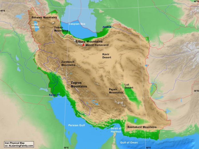
The Iran physical map is provided. The physical map includes a list of major landforms and bodies of water of Iran.
A student may use the blank Iran outline map to practice locating these physical features.
Features of the Iran Physical Map
Bodies of Water
- Caspian Sea
- Gulf of Oman
- Persian Gulf
- Strait of Hormuz
Major Landforms
- Atrek River
- Bashakerd Mountains
- Elburz Mountains
- Karun River
- Kavir Desert
- Lake Urmia
- Lut Desert
- Mount Damavand
- Payeh Mountains
- Sablan Mountains
- Talesh Mountains
- Zagros Mountains
- Zardkouh Mountains

