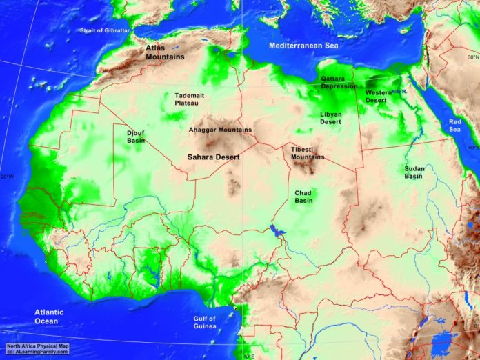
The North Africa physical map is provided. The physical map includes a list of major landforms and bodies of water of North Africa.
A student may use the blank North Africa outline map to practice locating these physical features.
Features of the North Africa Physical Map
Bodies of Water
- Atlantic Ocean
- Gulf of Guinea
- Mediterranean Sea
- Red Sea
- Strait of Gibraltar
Major Landforms
- Ahaggar Mountains
- Atlas Mountains
- Chad Basin
- Djouf Basi
- Libyan Dessert
- Nile River
- Qattara Depression
- Sahara Desert
- Sudan Basin
- Tademait Plateau
- Tibesti Mountains
- Western Desert

