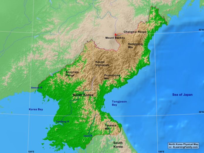
The North Korea physical map is provided. The physical map includes a list of major landforms and bodies of water of North Korea.
A student may use the blank North Korea outline map to practice locating these physical features.
Features of the North Korea Physical Map
Bodies of Water
- Korea Bay
- Sea of Japan
- Tongjoson Bay
Major Landforms
- Amnok River
- Changbai Range
- Hamgyung Mountains
- Imjin River
- Kaema Highlands
- Kangnam Range
- Mount Baekdu
- Pujonryong Mountains
- Taebeck Mountains
- Taedong River

