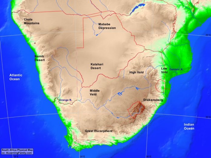
The Southern Africa physical map is provided. The physical map includes a list of major landforms and bodies of water of Southern Africa.
A student may use the blank map to practice locating these political and physical features.
Features of the Southern Africa Physical Map
Bodies of Water
- Atlantic Ocean
- Indian Ocean
Major Landforms
- Chola Mountains
- Drakensberg
- Great Escarpment
- High Veld
- Kalahari Desert
- Low Veld
- Mababe Depression
- Middle Veld
- Namib Desert
- Orange River
- Zambezi River

