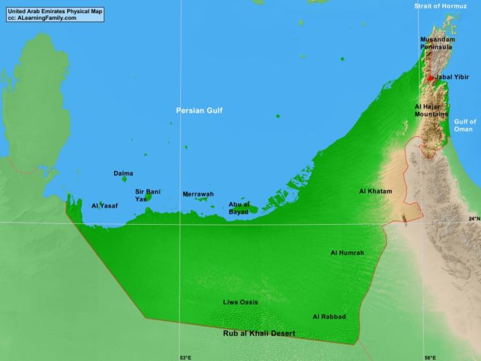
The United Arab Emirates physical map is provided. The physical map includes a list of major landforms and bodies of water of the United Arab Emirates.
A student may use the blank United Arab Emirates outline map to practice locating these physical features.
Features of the United Arab Emirates Physical Map
Bodies of Water
- Gulf of Oman
- Persian Gulf
- Strait of Hormuz
Major Landforms
- Abu al Bayad Island
- Al Hajar Mountains
- Al Humrah
- Al Khatam
- Al Rabbad
- Al Yasaf Island
- Dalma Island
- Jabal Yibir
- Liwa Oasis
- Merrawah Island
- Musandam Peninsula
- Rub Al Khali Desert
- Sir Bani Yas Island

