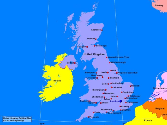
The United Kingdom political map is provided. The political map includes a list of neighboring countries and major cities of the United Kingdom.
A student may use the blank United Kingdom outline map to practice locating these political features.
Features of the United Kingdom Political Map
Neighboring Countries
- Belgium
- France
- Ireland
- Netherlands
- Norway
Major Cities
- London (capital)
- Aberdeen
- Birmingham
- Blackpool
- Bournemouth
- Bristol
- Cambridge
- Cardiff
- Cheltenham
- Colchester
- Derby
- Dundee
- Edinburgh
- Exeter
- Glasgow
- Kingston upon Hull
- Leicester
- Liverpool
- Luton
- Manchester
- Middlesbrough
- Newcastle upon Tyne
- Norwich
- Nottingham
- Oxford
- Plymouth
- Portsmouth
- Sheffield
- Swansea
- Worcester
- York

