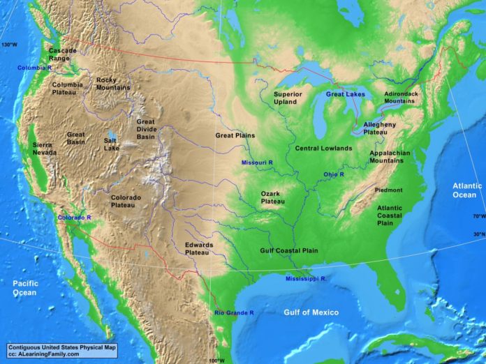
The contiguous USA physical map is provided. The physical map includes a list of major landforms and bodies of water of the contiguous USA.
A student may use the blank Contiguous USA outline map to practice locating these physical features.
Features of the Contiguous USA Physical Map
Bodies of Water
- Atlantic Ocean
- Gulf of Mexico
- Pacific Ocean
Major Landforms
- Adirondack Mountains
- Allegheny Plateau
- Appalachian Mountains
- Atlantic Coastal Plain
- Cascade Range
- Central Lowlands
- Colorado Plateau
- Colorado River
- Columbia Plateau
- Columbia River
- Edwards Plateau
- Great Basin
- Great Divide Basin
- Great Plains
- Gulf Coastal Plain
- Mississippi River
- Missouri River
- Ohio River
- Ozark Plateau
- Piedmont
- Rio Grande River
- Rocky Mountains
- Salt Lake
- Sierra Nevada
- Superior Upland

