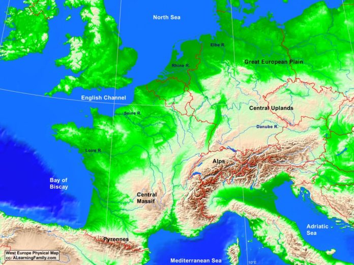
The West Europe physical map is provided. The physical map includes a list of major landforms and bodies of water of West Europe.
A student may use the blank West Europe outline map to practice locating these physical features.
Features of the West Europe Physical Map
- Croatia
- Czech Republic
- Denmark
- Hungary
- Ireland
- Italy
- Poland
- Slovakia
- Spain
- United Kingdom
Countries and Capital Cities
- Austria (Vienna)
- Belgium (Brussels)
- France (Paris)
- Germany (Berlin)
- Luxembourg (Luxembourg)
- Netherlands (Amsterdam)
- Switzerland (Bern)
Bodies of Water
- Adriatic Sea
- Bay of Biscay
- English Channel
- Mediterranean Sea
- North Sea
Major Landforms
- Alps
- Central Massif
- Central Uplands
- Danube River
- Elba River
- Great European Plain
- Loire River
- Pyrennes Mountains
- Rhine River
- Seine River

