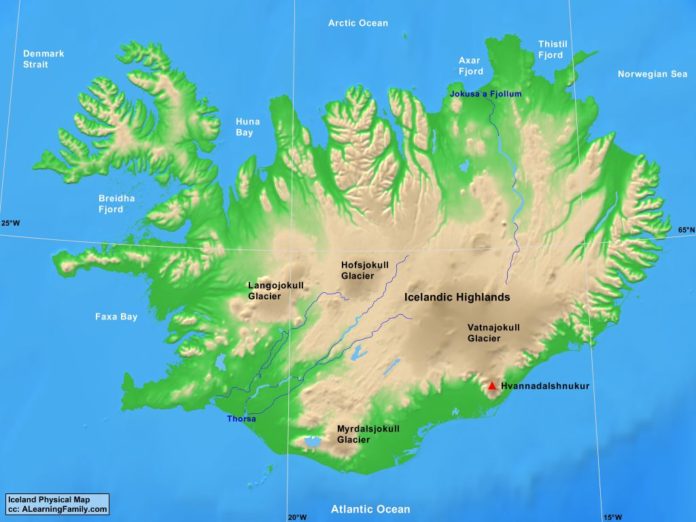
The Iceland physical map is provided. The physical map includes a list of major landforms and bodies of water of Iceland.
A student may use the blank Iceland outline map to practice locating these physical features.
Features of the Iceland Physical Map
Bodies of Water
- Arctic Ocean
- Atlantic Ocean
- Axar Fjord
- Breidha Fjord
- Denmark Strait
- Faxa Bay
- Huna Bay
- Norwegian Sea
- Thistil Fjord
Major Landforms
- Hofsjokull Glacier
- Hvannadalshnukur
- Icelandic Highlands
- Jokusa a Fjollum
- Langojokull Glacier
- Myralsjokull Glacier
- Thorsa
- Vatnajokull Glacier

