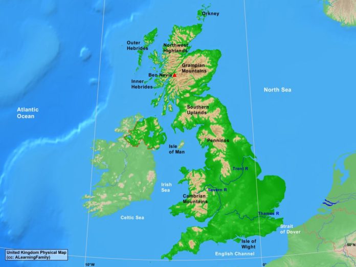
The United Kingdom physical map is provided. The physical map includes a list of major landforms and bodies of water of the United Kingdom.
A student may use the blank United Kingdom outline map to practice locating these physical features.
Features of the United Kingdom Physical Map
Bodies of Water
- Atlantic Ocean
- Celtic Sea
- English Channel
- Irish Sea
- North Sea
- Strait of Dover
Major Landforms
- Ben Nevis
- Cambrian Mountains
- Grampian Mountains
- Inner Hebrides
- Isle of Man
- Isle of Wight
- Northwest Highlands
- Outer Hebrides
- Pennines
- Severn River
- Southern Uplands
- Thames River
- Trent River

