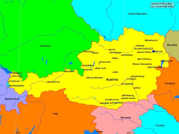
The Austria political map is provided. The political map includes a list of neighboring countries and major cities of Austria.
A student may use the blank Austria outline map to practice locating these political features.
Features of the Austria Political Map
Neighboring Countries
- Czech Republic
- Germany
- Hungary
- Italy
- Liechtenstein
- Slovakia
- Slovenia
- Switzerland
Major Cities
- Vienna (capital)
- Amstetten
- Ansfelden
- Bad Ischi
- Bad Voslau
- Bischofshofen
- Braunau
- Bregenz
- Dornbirn
- Eisenstadt
- Feldkirch
- Feldkirchen
- Gmunden
- Graz
- Hall
- Hallein
- Innsbruck
- Kapfenberg
- Klagenfurt
- Klosterneuburg
- Knittelfeld
- Krems
- Kufstein
- Leoben
- Linz
- Mistelbach
- Neunkirchen
- Ried
- Salzburg
- Sankt Andra
- Sankt Polten
- Steyr
- Villach
- Wiener Neustadt
- Wolfsberg

