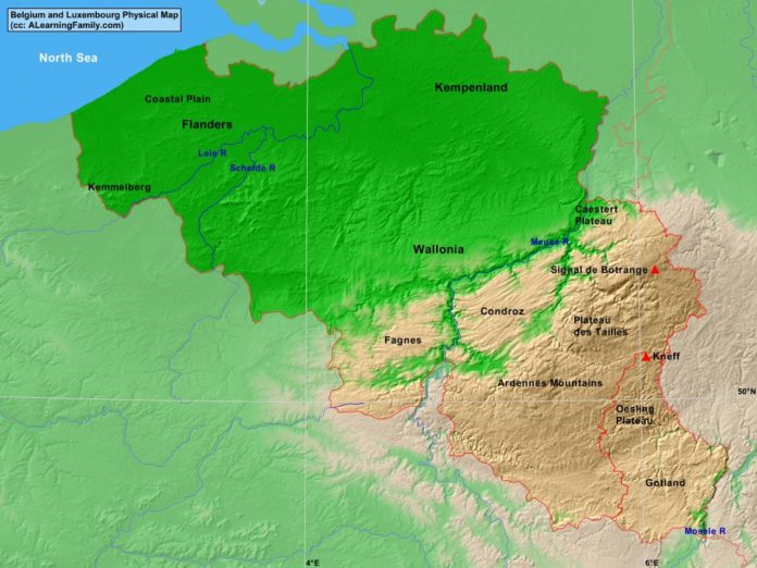
The Belgium and Luxembourg physical map is provided. The physical map includes a list of major landforms and bodies of water of Belgium and Luxembourg.
A student may use the blank Belgium and Luxembourg outline map to practice locating these physical features.
Features of the Belgium and Luxembourg Physical Map
Bodies of Water
- North Sea
Major Landforms
- Ardennes Mountains
- Caestert Plateau
- Coastal Plain
- Condroz
- Fagnes
- Flanders
- Gotland
- Kemmelberg
- Kneff
- Leie River
- Meuse River
- Oesling Plateau
- Plateau de Tailles
- Schelde River
- Signal de Botrange
- Wallonia

