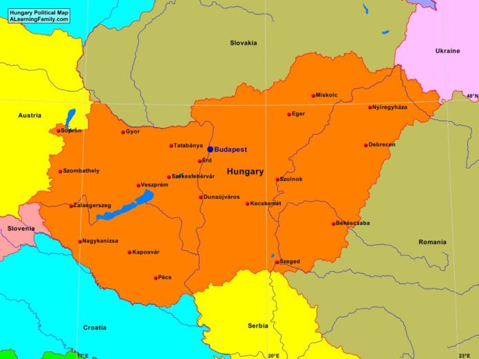
The Hungary political map is provided. The political map includes a list of neighboring countries and major cities of Hungary.
A student may use the blank Hungary outline map to practice locating these political features.
Features of the Hungary Political Map
Neighboring Countries
- Austria
- Croatia
- Romania
- Serbia
- Slovakia
- Slovenia
- Ukraine
Major Cities
- Budapest (capital)
- Bekescaba
- Debrecen
- Dunaujvaros
- Eger
- Erd
- Gyor
- Kaposvar
- Kecskemet
- Miskolc
- Nagykaniszsa
- Nyiregyhaza
- Pecs
- Sopron
- Szeged
- Szolnok
- Szombathely
- Tatabanya
- Veszprem
- Zalaegerszeg
Bibliography
- Hungary Outline Map
- Hungary Physical Map
- Hungary

