Monday, May 20, 2024
Home Blog Page 3

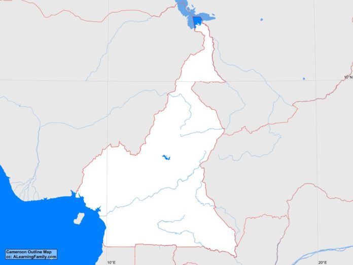
Cameroon Outline Map

Cameroon outline map
A blank outline map of Cameroon (Creative Commons: A Learning Family).

The Cameroon outline map is provided. The outline map includes a list of neighboring countries, major cities, major landforms and bodies of water of Cameroon.

A student may use the blank map to practice locating these political and physical features.

Features of the Cameroon Outline Map

Neighboring Countries

  • Central African Republic
  • Chad
  • Equatorial Guinea
  • Gabon
  • Nigeria
  • Republic of the Congo

Major Cities

  • Yaounde (capital
  • Bafoussam
  • Bamenda
  • Bertoua
  • Douala
  • Edea
  • Garoua
  • Koumba
  • Kousseri
  • Loum
  • Maroua
  • Mbouda
  • Mokolo
  • Ngaoundere
  • Nkongsamba

Bodies of Water

  • Atlantic Ocean
  • Lake Chad

Major Landforms

  • Adamawa Plateau
  • Alantika Mountains
  • Benue River
  • Coastal Plain
  • Dja River
  • Mambila Mountains
  • Mandara Mountains
  • Mbam River
  • Mount Cameroon
  • Sanga River
  • South Cameroon Plateau
  • Vina River

Bibliography

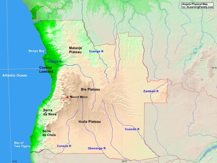
Angola Physical Map

Angola physical map
A physical map of Angola (Creative Commons: A Learning Family).

The Angola physical map is provided. The physical map includes a list of major landforms and bodies of water of Angola.

A student may use the blank Angola outline map to practice locating these physical features.

Features of the Angola Physical Map

Bodies of Water

  • Atlantic Ocean
  • Bay of Two Tigers
  • Bengo Bay

Major Landforms

  • Bie Plateau
  • Coastal Lowland
  • Cuando River
  • Cuango River
  • Cuanza River
  • Cunene River
  • Huila Plateau
  • Malanje Plateau
  • Mount Moco
  • Okavango River
  • Serra da Chela
  • Serra da Neve
  • Zambezi River

Bibliography

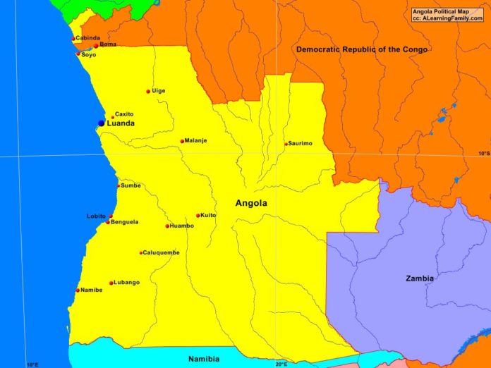
Angola Political Map

Antola political map
A political map of Angola (Creative Commons: A Learning Family).

The Angola political map is provided. The political map includes a list of neighboring countries and major cities of Angola.

A student may use the blank Angola outline map to practice locating these political features.

Features of the Angola Political Map

Neighboring Countries

  • Democratic Republic of the Congo
  • Namibia
  • Zambia

Major Cities

  • Luanda (capital)
  • Benguela
  • Boma
  • Cabinda
  • Caluquembe
  • Caxito
  • Huambo
  • Kuito
  • Lobito
  • Lubango
  • Malanje
  • Namibe
  • Saurimo
  • Soyo
  • Sumbe
  • Uige

Bibliography

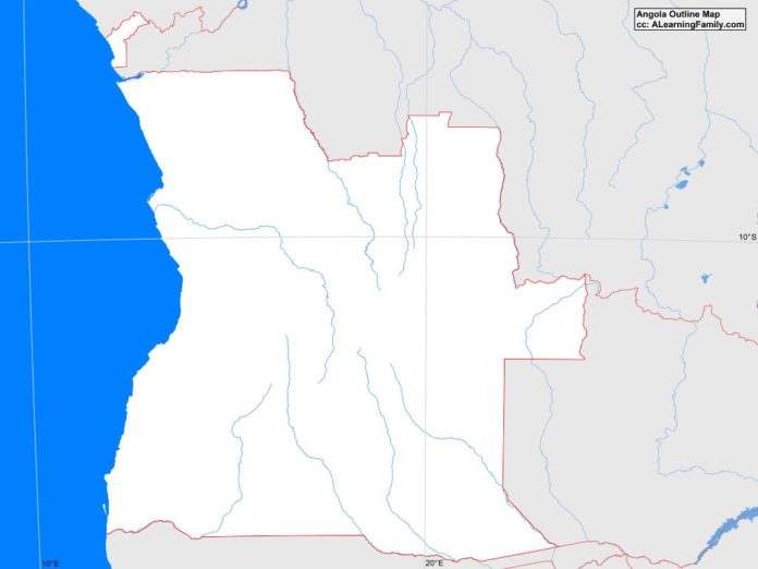
Angola Outline Map

Angola outline map
A blank outline map of Angola (Creative Commons: A Learning Family).

The Angola outline map is provided. The outline map includes a list of neighboring countries, major cities, major landforms and bodies of water of Angola.

A student may use the blank map to practice locating these political and physical features.

Features of the Angola Outline Map

Neighboring Countries

  • Democratic Republic of the Congo
  • Namibia
  • Zambia

Major Cities

  • Luanda (capital)
  • Benguela
  • Boma
  • Cabinda
  • Caluquembe
  • Caxito
  • Huambo
  • Kuito
  • Lobito
  • Lubango
  • Malanje
  • Namibe
  • Saurimo
  • Soyo
  • Sumbe
  • Uige

Bodies of Water

  • Atlantic Ocean
  • Bay of Two Tigers
  • Bengo Bay

Major Landforms

  • Bie Plateau
  • Coastal Lowland
  • Cuando River
  • Cuango River
  • Cuanza River
  • Cunene River
  • Huila Plateau
  • Malanje Plateau
  • Mount Moco
  • Okavango River
  • Serra da Chela
  • Serra da Neve
  • Zambezi River

Bibliography

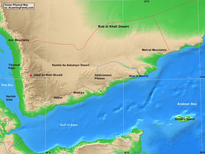
Yemen Physical Map

Yemen physical map
A physical map of Yemen (Creative Commons: A Learning Family).

The Yemen physical map is provided. The physical map includes a list of major landforms and bodies of water of Yemen.

A student may use the blank Yemen outline map to practice locating these physical features.

Features of the Yemen Physical Map

Bodies of Water

  • Arabian Sea
  • Gulf of Aden
  • Red Sea

Major Landforms

  • Abyan
  • Asir Mountains
  • Hadhramaut Plateau
  • Hanish Isles
  • Jabal an-Nabi Shuaib
  • Mahrat Mountains
  • Ramlat As-Sabatayn Desert
  • Rub al Khali Desert
  • Shabwa
  • Socotra Island
  • Tihamah Plain
  • Wadi al Masilah

Bibliography

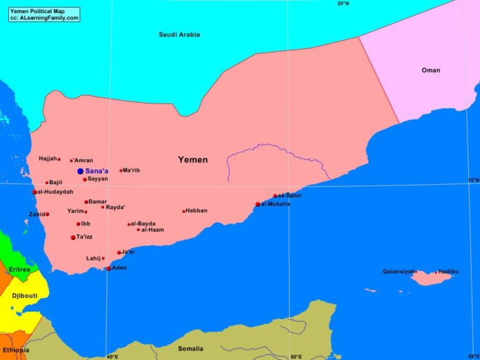
Yemen Political Map

Yemen political map
A political map of Yemen (Creative Commons: A Learning Family).

The Yemen political map is provided. The political map includes a list of neighboring countries and major cities of Yemen.

A student may use the blank Yemen outline map to practice locating these political features.

Features of the Yemen Political Map

Neighboring Countries

  • Djibouti
  • Eritrea
  • Oman
  • Saudi Arabia
  • Somalia

Major Cities

  • Sana’a (capital)
  • Aden
  • al-Hazm
  • al-Hudaydah
  • al-Mukaila
  • Amran
  • As-Sahir
  • Bajil
  • Damar
  • Habban
  • Hadibu
  • Hajjah
  • Ibb
  • Ja’ar
  • Lahij
  • Ma’rib
  • Qaiansiyah
  • Rayda
  • Sayyan
  • Ta’izz
  • Yarim
  • Zabid

Bibliography

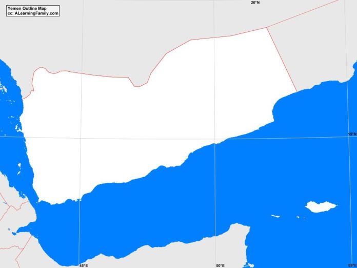
Yemen Outline Map

Yemen outline map
A blank outline map of Yemen (Creative Commons: A Learning Family).

The Yemen outline map is provided. The outline map includes a list of neighboring countries, major cities, major landforms and bodies of water of Yemen.

A student may use the blank map to practice locating these political and physical features.

Features of the Yemen Outline Map

Neighboring Countries

  • Djibouti
  • Eritrea
  • Oman
  • Saudi Arabia
  • Somalia

Major Cities

  • Sana’a (capital)
  • Aden
  • al-Hazm
  • al-Hudaydah
  • al-Mukaila
  • Amran
  • As-Sahir
  • Bajil
  • Damar
  • Habban
  • Hadibu
  • Hajjah
  • Ibb
  • Ja’ar
  • Lahij
  • Ma’rib
  • Qaiansiyah
  • Rayda
  • Sayyan
  • Ta’izz
  • Yarim
  • Zabid

Bodies of Water

  • Arabian Sea
  • Gulf of Aden
  • Red Sea

Major Landforms

  • Abyan
  • Asir Mountains
  • Hadhramaut Plateau
  • Hanish Isles
  • Jabal an-Nabi Shuaib
  • Mahrat Mountains
  • Ramlat As-Sabatayn Desert
  • Rub al Khali Desert
  • Shabwa
  • Socotra Island
  • Tihamah Plain
  • Wadi al Masilah

Bibliography

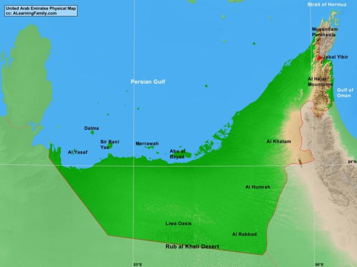
United Arab Emirates Physical Map

United Arab Emirates physical map
A physical map of the United Arab Emirates (Creative Commons: A Learning Family).

The United Arab Emirates physical map is provided. The physical map includes a list of major landforms and bodies of water of the United Arab Emirates.

A student may use the blank United Arab Emirates outline map to practice locating these physical features.

Features of the United Arab Emirates Physical Map

Bodies of Water

  • Gulf of Oman
  • Persian Gulf
  • Strait of Hormuz

Major Landforms

  • Abu al Bayad Island
  • Al Hajar Mountains
  • Al Humrah
  • Al Khatam
  • Al Rabbad
  • Al Yasaf Island
  • Dalma Island
  • Jabal Yibir
  • Liwa Oasis
  • Merrawah Island
  • Musandam Peninsula
  • Rub Al Khali Desert
  • Sir Bani Yas Island

Bibliography

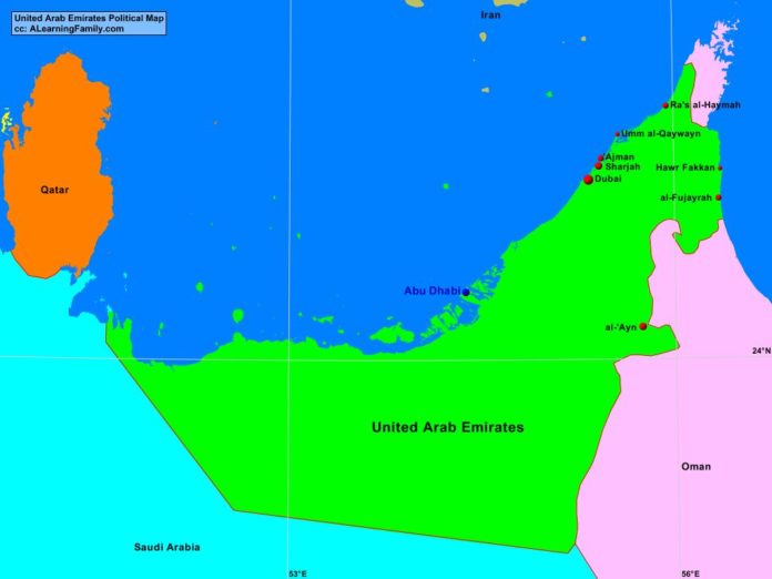
United Arab Emirates Political Map

United Arab Emirates political map
A political map of the United Arab Emirates (Creative Commons: A Learning Family).

The United Arab Emirates political map is provided. The political map includes a list of neighboring countries and major cities of the United Arab Emirates.

A student may use the blank United Arab Emirates outline map to practice locating these political features.

Features of the United Arab Emirates Political Map

Neighboring Countries

  • Iran
  • Oman
  • Qatar
  • Saudi Arabia

Major Cities

  • Abu Dhabi(capital)
  • Ajman
  • al-Ayn
  • al-Fujayrah
  • Dubai
  • Hawr Fakkan
  • Ra’s al-Haymah
  • Sharjah
  • Umm al-Qaywayn

Bibliography

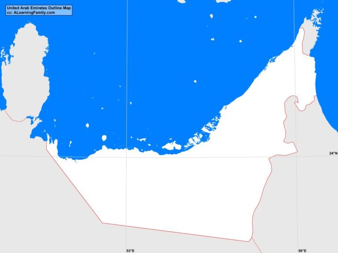
United Arab Emirates Outline Map

United Arab Emirates outline map
A blank outline map of the United Arab Emirates (Creative Commons: A Learning Family).

The United Arab Emirates outline map is provided. The outline map includes a list of neighboring countries, major cities, major landforms and bodies of water of United Arab Emirates.

A student may use the blank map to practice locating these political and physical features.

Features of the United Arab Emirates Outline Map

Neighboring Countries

  • Iran
  • Oman
  • Qatar
  • Saudi Arabia

Major Cities

  • Abu Dhabi(capital)
  • Ajman
  • al-Ayn
  • al-Fujayrah
  • Dubai
  • Hawr Fakkan
  • Ra’s al-Haymah
  • Sharjah
  • Umm al-Qaywayn

Bodies of Water

  • Gulf of Oman
  • Persian Gulf
  • Strait of Hormuz

Major Landforms

  • Abu al Bayad Island
  • Al Hajar Mountains
  • Al Humrah
  • Al Khatam
  • Al Rabbad
  • Al Yasaf Island
  • Dalma Island
  • Jabal Yibir
  • Liwa Oasis
  • Merrawah Island
  • Musandam Peninsula
  • Rub Al Khali Desert
  • Sir Bani Yas Island

Bibliography

Featured Posts